Airbus Aerial used a drone to provide a map of Atlanta Hartsfield International Airport.
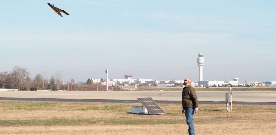
Airbus Aerial, the commercial aerial services business launched by Airbus last year, recently conducted runway mapping and inspections at Atlanta Hartsfield-Jackson International airport (KATL). Aerial fuses satellite and drone data into custom-tailored, client-specific packages with easy-to-use interpretation tools. Airport officials requested Aerial conduct mapping of its south runway to help it assess the benefits of using this service to conduct critical runway inspections.
The Aerial team used an autonomous senseFly eBee Plus drone with RTK GPS capabilities to capture aerial images of the runway with an accuracy of less than 5 cm. It is fully automated and can map an entire runway in one flight with a single operator. Airbus Aerial used the drone images to develop a comprehensive airport assessment report, including 3D mapping, contour layers, and traditional high-resolution imagery within Aerial’s cloud-based geospatial platform.
The company plans to offer the service to other airports. It currently has clients in utilities, railroads, construction, and insurance. Aerial has conducted beyond visual line of sight (BVLOS) inspections of power lines for the region’s largest utility, the Southern Company. That also marked the first time drone and satellite imaging technologies have been used jointly for powerline inspections, and the first BVLOS drone operation in Georgia.
source : Airbusaerial